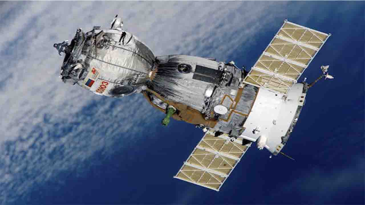
Bangladesh (Commonwealth) _ Bangladesh will become one of a select few nations in the world with a sovereign earth observation satellite with the launch of the Bangabandhu-2 satellite.
François Royer, sales and marketing director of Airbus Defence and Space – Space Systems, told a group of journalists who visited its headquarters in Toulouse, France, on Tuesday, “We are collaborating with BSCL to establish the right approach.”
For the Bangabandhu-2, which would be the nation’s first earth observation satellite, the Bangladesh Satellite Company Ltd (BSCL) and Airbus have already signed a statement of intent.
While Emmanuel Macron, the president of France, was in Dhaka, this document was signed. The initial satellite for Bangladesh was primarily intended for communication. According to the Airbus director, the Bangabandhu-2 will join a network of satellites, strengthening Bangladesh’s status as a spacefaring nation.
The most important thing is that having a satellite gives you independence and power. According to Royer, you’ll be able to operate the satellite secretly and autonomously. Few countries in the world have this level of autonomy, and Bangladesh will hopefully be one of them, he continued. Once you have the satellite, you would be able to collect photographs from any location, he continued.
Weather forecasting, television signal transmission, amateur radio, internet communications, and the Global Positioning System are just a few of the many uses for satellites. Additionally, they are used for data collecting, research, and solar system observations.
Land-based services, mapping, environmental monitoring, and agriculture are some of the major fields that use satellite imaging. Bangladesh already bought these photographs from outside sources.
Geospatial statistics from satellites provide fast and precise help for defining and evaluating agricultural strategies at the district level. This include calculating crop yield, crop acreage, fertilizer needs, and irrigation requirements. Cities can plan, forecast, and manage their growth and development by employing satellites, according to Hugues Pavie, head of intelligence business growth for the Asia-Pacific.
Earth observation is revolutionary. It offers objective data at an unparalleled rate, with local accuracy on a global scale. According to him, it fuels automated assessments that direct decision-making and practical actions. We’re talking about a constellation of satellites,” Royer stated in reference to Bangladesh. In Bangladesh, clouds and fog are significant because they pose challenges. To look past these obstructions, we therefore need to combine sensors.
Royer claimed that Bangladesh may produce satellites in the future with the appropriate strategy. “Bangladesh is capable of producing satellites. He said, “If you have the capacity, you can do it profitably. Airbus would help Bangladesh develop its capacity.
France and Bangladesh decided to work together in the areas of ICT and digital technology, particularly artificial intelligence, during the French president’s visit to Bangladesh. In this context, France invited Bangladesh to take into account joining programs like the Global Partnership on Artificial Intelligence.
A “contribution” from France to the 2041 Vision of a Smart Bangladesh was recognised by President Macron and Prime Minister Sheikh Hasina in their joint statement.
With the launch of the Bangabandhu-2, Bangladesh will join a select group of nations that have their own independent earth observation satellite. The Bangladesh Satellite Company Ltd (BSCL) and Airbus have agreed to work together to construct a satellite that will strengthen the nation’s standing in space exploration.
The importance of having a satellite in terms of offering a nation autonomy and sovereignty was stressed by François Royer, sales and marketing director of Airbus Defence and Space – Space Systems. Bangladesh will be able to run it securely and autonomously thanks to the Bangabandhu-2. Bangladesh will be able to collect photographs from any location thanks to the satellite, transforming industries including weather forecasting, TV signal transmission, research, and agriculture.
Bangladesh will no longer need to buy satellite images from outside sources. Geospatial statistics obtained from satellite data can provide precise and timely assistance in a number of fields, including mapping, agriculture, environmental monitoring, and land-based services.
Geospatial statistics obtained from satellite data can provide precise and timely assistance in a number of fields, including mapping, agriculture, environmental monitoring, and land-based services. Additionally, the satellite will deliver localized, unbiased data on a global scale, enabling better-informed decision-making. Bangladesh’s cloud cover and fog present hurdles, but the satellite will be able to get around them thanks to its cutting-edge sensors.
In addition, Airbus wants to help Bangladesh build up its capability to produce satellites in the future. Also highlighted was the partnership between Bangladesh and France in the domains of ICT, digital technology, and AI. In line with Bangladesh’s desire for a brighter future, France invited Bangladesh to take part in the Global Partnership on Artificial Intelligence.


